Watch Duty: Wildfire Maps
By Sherwood Forestry Service, Inc.
- Category News
- Release Date 2021-08-10
- Current Version 2024.4.9
- File Size 44.35 MB
- Links Google Play
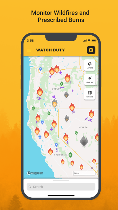
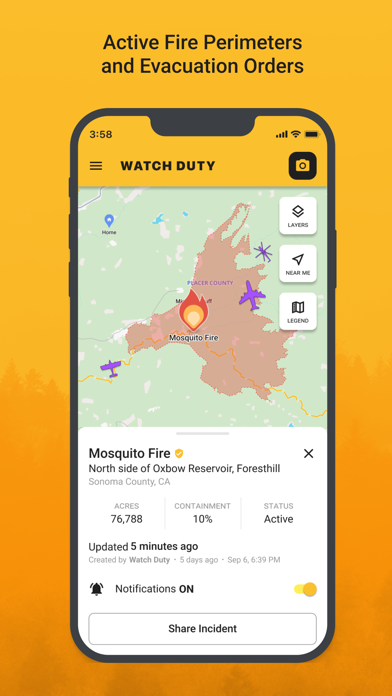
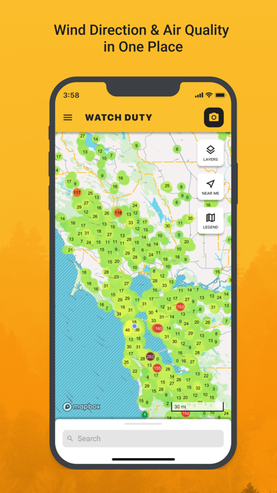
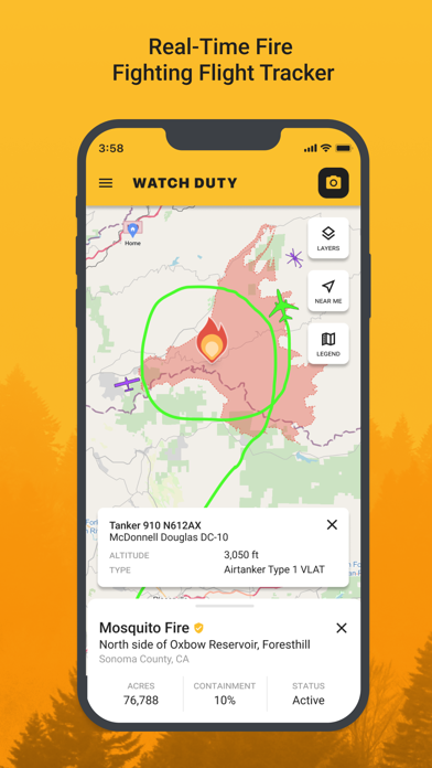
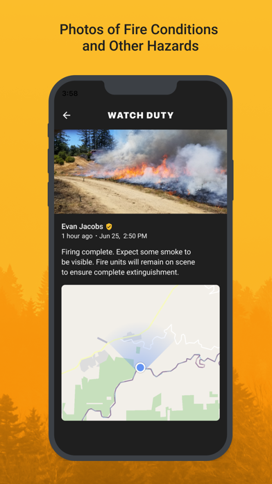
Watch Duty is the only wildfire mapping and alert app powered by real people giving you real-time information vetted by trained professionals, not robots. All other apps rely on only government alerts which can be hours late or flat out non-existent. Watch Duty is run by active and retired firefighters, dispatchers, first responders, and reporters who monitor radio scanners in your area around the clock to bring you up-to-the-minute life saving information. Wildfire tracking features: - Push notifications about nearby wildfires and ongoing firefighting efforts - Real-time updates as conditions change - Active fire perimeters and progress - Infrared satellite hotspot from VIIRS and MODIS - Wind speed and direction - Evacuation orders & shelter information - Historical wildfire perimeters - Street and satellite maps - Air attack and air tanker flight tracker - Saved locations on the map Watch Duty is a 501(c)(3) non-profit organization that will always provide an unparalleled FREE service at no cost, forever. Our maps and alerting will always remain free but if you become a member for $25/year you will receive special features as a token of our appreciation. Your membership dues will support our free service for all and remain free of advertising or sponsorship. If you’d like to drop us a line, learn more, or ask questions you can reach us anytime at support.watchduty.org. We’d love to hear from you.