GPS & Maps: Location Tracker
By Kraus und Karnath GbR 2Kit Consulting
- Category Navigation
- Release Date 2011-11-23
- Current Version 4.2
- File Size 37.13 MB
- Links Google Play
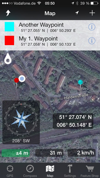
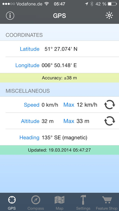
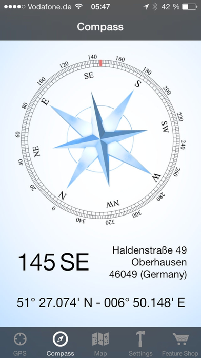
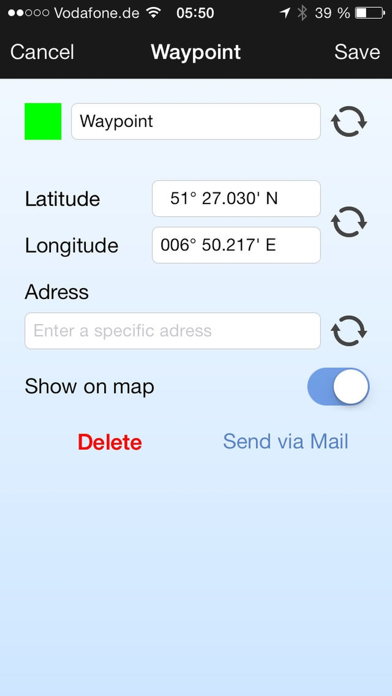
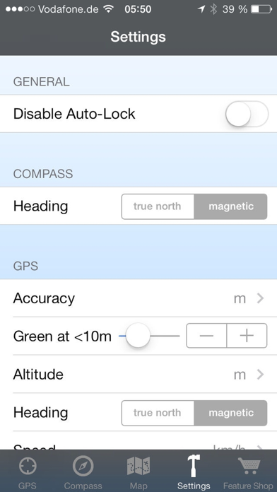
GPS & Maps is a simple, yet powerful GPS app for supporting navigation and outdoor activities like geocaching, sailing, skating, trekking, biking or traveling by airplane. It measures your position, height and acceleration with accuracy information and in different units like feet, meter, miles and kilometers. Your highest altitude and speed will also be logged. You can show and save your current position or other waypoints on a map and pick one of the following formats to view your coordinates: - GPS Coordinates (Latitude/Longitude) - Decimal Degrees - Degrees/Minutes/Seconds - UTM: Universal Transverse Mercator - MGRS: Military Grid Reference System GPS & Maps is a must have for geocachers, due to the easy switching between coordinates and map. The integrated flashlight enables users like geocachers to find targets even in dark environments without having to use a separate device. Via in-app purchase you can add some useful features to GPS & Maps: - Premium Edition: Unlock all of the following features. - Waypoints: Save your current location as a marker on the map. Add new locations like geo caches to the map by entering GPS coordinates. Pick different colors for waypoints. Export waypoints via e-mail. Show or hide saved waypoints on the map. - Map Widgets: The draggable Map Widgets show your location, altitude, speed, address and GPS accuracy directly on the map. You can change the widget transparency and textcolor in the settings to optimize readability on different map tiles and map data sources like Google Maps or Open Street Map. - Compass: The compass shows your heading relative to magnetic north or true north (configurable in the settings) and your current location coordinates. It also shows additional information like street, city and country. If you buy Compass and Map Widgets the Compass will also be displays as a widget on the map. - Open Street Map: This feature enhances the map with additional map data from Open Street Map. - Google Maps: This feature enhances the map with additional map data from Google Maps. The map modes 'standard', 'satellite', 'hybrid' and 'terrain' can be selected in the options menu. - iCloud Backup & Restore Please keep in mind that the accuracy of your position and acceleration always depends on the intensity of the available GPS signal. Compass and heading information are only available on devices with magnetometer.