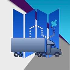
HD1.1 Route Planner
By Gary Gibbs
- Category Productivity
- Release Date 2026-02-24
- Current Version 26.1
- File Size 6.71 MB
- Links Google Play
The road transport of Dangerous Goods Class 1 poses significant hazards to the public and infrastructure. While governing bodies and agencies in many countries have implemented detailed regulations and policies to manage the transportation of Class 1 dangerous goods, supported by international guidelines, gaps are likely to exist. These gaps tend to relate on the transit risk nature of the movement of dangerous goods, where it is often impossible to mitigate consequences to the public without significant cost and impact. The DG Route Planner app does not address these gaps, instead offering a simple approach to enhance awareness and understanding of the consequences to assist route planning and highlight potential risk outcomes along the planned route. However, the outcomes presented in this app should not be used to inform decisions on safety-related matters or for compliance purposes. From a functional perspective, the app is designed to assist with planning, saving and reviewing road movement routes using real-world navigation data supplied by Apple Maps integration. Users can create routes, generate summary reports, store frequently used locations and overlay consequence zones at start and end locations, as well as along the route. A ‘user guide’ is available in the app that provides an overview of features and further enhancements are planned for future releases. This edition of the app is more of a concept demonstrator with focus on Class 1 Hazard Division 1.1. A more advanced version with focus on both military and commercial types of Dangerous Goods is planned. Background The methodology behind the app is not approved or endorsed by any authority or international body. Instead, it is based on the author’s adaptation of Quantity-Distance (QD) principles widely used in the storage of explosives. The choice of transit consequence zone distances is based on AASTP-1 Public Traffic Route Distances, reflecting a reversal of the scenario. Instead of vehicle traffic (classified as transit Exposed Sites) with respect to a fixed Potential Explosive Site (PES), the explosive load being transported is now in transit and all buildings and infrastructure are fixed. The author is open to feedback and suggestions for a more effective approach to determining transit consequence zones. Disclaimer Statement The outcomes presented in this application have been technically validated to the extent feasible by the developer. However, it is imperative for the user to be cognisant that this application is solely intended for advisory purposes. It has not undergone authoritative approval or endorsement by NATO or any other organisation. Consequently, the developer cannot be held liable for any unforeseen mishaps or erroneous decisions arising from the utilisation of this application.